Click
here to jump straight down to updates
for this scheme.
The A2 Shore Road forms the route from the end
of the M5 all the way to Carrickfergus, taking
it through the commuter suburbs of Whiteabbey,
Jordanstown and the village of Greenisland. A
short section at the Whiteabbey end and a
section near Carrickfergus are dual-carriageway,
while most of the rest is 4-lane
single-carriageway. The exception is the short
section through Greenisland village which is
2-lane single carriageway. This is a serious
bottleneck and causes huge delays and much
stress every day for the vehicles which travel
along the route (26,000 per day north of
Greenisland; 35,000 south of Greenisland).
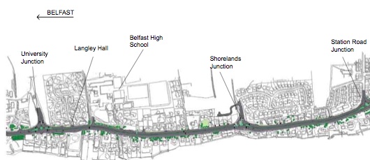
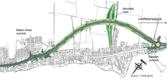
The new road follows the route shown in the
below map (the other two options were rejected).
For those who are interested, TransportNI have
more detailed maps here.
Map of proposals (southern end)
released to the public in March 2007.
Map of
proposals (northern end) released to the public
in March 2007.
The road has been
built to dual-carriageway standard with two
lanes each way. There are four roundabouts, the
first three of which are signalised:
The Shore Road entrance to Ulster University
(previously a T-junction).
At "Shorelands" (previously a T-junction).
At Station Road, Greenisland (previously
traffic lights).
At Seapark (near the police station
entrance).
At all other junctions,
drivers are required to turn left only and use
the next roundabout along to turn round if they
wished to turn right. An exception has been made
at Station Road to allow buses only
to turn right into the former Shore Road from
the new road.
For completeness, the
three options considered before the decision was
made were:
Inland Option: routing a
new 4-lane road inland, to the west of the
existing road. This would involve the
demolition of 30 homes and impact on 5
gardens. It would utilise fields and some
largely undeveloped land attached to 2 schools
and 2 churches.
Online Option: widening the
existing road to 4 lanes. This would involve
the demolition of 27 homes and impact on 41
gardens.
Combined Option: widen
the Belfast end of the existing road, and
build a new road inland for the part of the
route from Station Road to Seapark. This would
involve the demolition of 23 homes and impact
on 25 gardens.
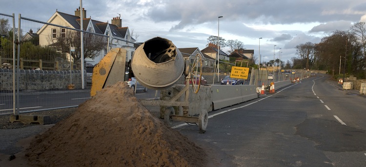
Progress
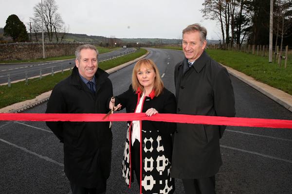
9 Dec 2015:
About ten weeks after both lanes each way opened
to traffic, the scheme was "officially"
opened on Thursday 3 December 2015 by the
new DRD Minister Michelle McIlveen (the event
ironically requiring a road closure!). In the
press release, the Minister comments that the
total cost of the scheme "is expected to be
up to £50 million" which is slightly below
the estimate of £57m given in 2012. The scheme
also attracted some EU finding - it's not clear
if the figure of £50m is the total scheme cost,
or just the cost paid by the DRD.
Congratulations to the contractor, Graham
Construction, and their subcontractors for an
excellent piece of work.
DRD Minister Michelle McIlveen officially
opening the scheme on 3 December 2015. The DRD
press release did not identify the other two
gentlemen, but they are probably representatives
of the DRD and/or the contractor, Graham
Construction [DRD].
9 Nov 2015:
All four lanes of the road have now been open
for six weeks now. It's still too early in my
view to properly assess the impact of the scheme
(let's leave that until January at the earliest)
but anecdotal evidence suggests the impact of
the scheme is greater in the evening peak than
the morning peak. In the morning peak,
congestion seems to have been shifted down to
Whiteabbey, but there is a more noticeable
impact in the evening. Not surprisingly, there
have been a number of 'teething issues'
including public wariness of the signalised
roundabouts, dissatisfaction of timings at
signalised pedestrian crossings and issues
relating to the cycle lane that runs to one side
of the new road, but hopefully these can be
sorted out in due course. I am now marking this
scheme as "completed", although minor works may
continue for some weeks yet.
26 Sep 2015:
As promised by the contractor, all four lanes of
the A2 Shore Road were opened to traffic on
Saturday, 25 Sep and were certainly open at 6pm
when Ian
Parsley traveled through. It’s not clear
whether they will remain open all weekend, but
it certainly seems almost certain that they will
be fully open on Monday morning. It is now over
two and a years since work began so both
residents and road users will really welcome the
fact that we are now at this stage. There will
of course need to be a few weeks to allow road
users to get used to the new road and the
junctions, but by early winter we should be in a
position to assess the impact that this scheme
has had. In terms of cost per kilometres it is
one of the most expensive road schemes built
here in recent years, mainly due to the very
high land costs along the route and the fact
that almost every inch of land purchased on the
online stretch was residential or commercial, as
opposed to open farmland.
3 Sep 2015:
The schools went back on Tuesday, 1 September
but many road users were frustrated that the
second lane in each direction has not yet opened
(currently only one lane each way is in use).
This led to significant congestion in the rush
hours this week. Although the DRD had
anticipated that the scheme would be completed
in August, there appear to have been some
delays. It’s possible that these delays relate
to the weather which can impact on works such as
laying concrete or tarmac. Local councillor John
Stewart put a
message on his Facebook page stating that
he had met the contractor and reported that “They
have confirmed that the scheme run over its
original completion date but that all works
will thankfully be finished by the 25th
September (3 weeks from now). They have
apologised for the delays suffered by
motorists this week heading into Belfast and
have now made some changes to road layout that
will hopefully see traffic flow better until
the scheme is finished.” I’m not clear on
what the "changes to road layout" might refer
to, but it does appear as if we could expect all
four lanes to be open to traffic on or before
25th September which is good news. The DRD
Minister, Danny Kennedy, resigned yesterday.
Although one of his first actions when he became
minister was to re-start the process that led to
the construction of this scheme, his resignation
unfortunately came just slightly too soon to see
it opened to traffic. Although the "old" bit of
Shore Road, between Seapark and Station Road, is
now bypassed and vehicles can no longer turn
right into it at Greenisland, vehicles can still
travel along this stretch citybound and rejoin
the new road at the Greenisland end. Anecdotal
evidence suggests large numbers of drivers were
doing this in the morning peak this week to
bypass the queues, which is an issue that the
DRD may need to address in due course. With
thanks to Denise Martin for letting me know
about Mr Stewart's post.
18 Aug 2015:
Four days after the previous update, I managed
to get an hour away from the baby and enjoyed
travelling the length of the scheme this
afternoon. As reported, one lane is open in each
direction, and all four roundabouts are now in
use. The first three (University, Shorelands and
Station Road) will be signalised eventually, but
as of today only the lights at Station Road were
operational. The last roundabout, at Seapark, is
a conventional (ie, non-signalised) roundabout
and is also in use. The road has two sections -
an online upgrade from the University to Station
Road, and then an inland section from there to
Seapark (see map at the top of the page). The
“old” Shore Road bypassed by the offline section
is now accessible only from the Seapark
roundabout and was practically deserted today.
By contrast, the new road was stop-start all the
way from Jordanstown to Greenisland,
illustrating again that until the upgrade this
was almost certainly the most congested
inter-urban trunk road in Northern Ireland in
terms of vehicles per lane. It looks to me as if
completing the roundabouts is one of the only
significant tasks still to be done, and it would
not surprise me if we had all four lanes open
within three or four weeks. The pictures below
were taken today by yours truly, and are
arranged in order from south to north.
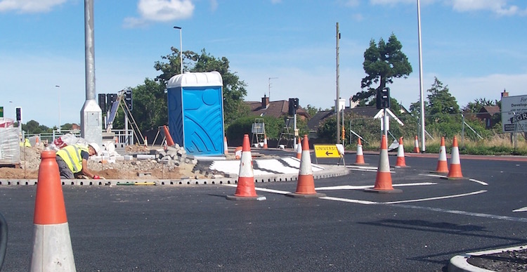
Pic 1: University roundabout seen on 18 Aug 2015
approaching from the Belfast direction. Note the
traffic signals now in place but not yet in use,
and the lane markings also completed. You can
see workers hard at work adding the brickwork to
the roundabout island, a task which is harder
than it looks due to the need to follow a curve.
And what must be the most "public" portaloo in
Belfast! [Wesley Johnston]
Pic 2: View north-east on the new road on 18 Aug
2015 from just north of the University
roundabout, close to Belfast High School. The
road here is basically complete to the point
that the soil in the central reservation was
being rotavated in places, presumably in
preparation for sowing grass (but will it be
cut?). Still one lane each direction with a
30mph speed limit. [Wesley Johnston]
Pic 3: Shorelands roundabout seen from
Shorelands on 18 Aug 2015, with the vehicles
visible travelling towards Carrickfergus on the
Shore Road. This will be a signalised roundabout
but as yet only the columns have been installed
and are awaiting their heads. The place is still
festooned with cones. [Wesley Johnston]
Pic 4: Between Shorelands and Station Road the
road is again basically completed, seen here
looking north east on 18 Aug 2015. The footway
on the right will host a cycle path, which was
noticeably in use in other locations by
cyclists. [Wesley Johnston]
Pic 5: We have lights! Station Road roundabout
operating as a bona-fide signalised roundabout
on 18 Aug 2015. Note the tan-coloured high
friction surface, designed to reduce the chance
of heavy braking turning into a skid. [Wesley
Johnston]
Pic 6: The offline stretch, which has been open
for two and a half months now, has a
surprisingly rural feel to it by virtue of
running inland past the heavily developed shore.
Seen on 18 Aug 2015 when it still has a 30mph
speed limit. [Wesley Johnston]
Pic 7: I was reluctant to take too many photos
at Seapark due to the huge PSNI station entrance
and the presence of a number of officers on
guard. This view is taken from further back
looking north-east from the "old" Shore Road
towards the new roundabout on 18 Aug 2015. The
silver car is passing round the central island
of the roundabout. [Wesley Johnston]
Pic 8: Same location as previously, but turning
and looking towards Belfast along the "old"
Shore Road. The road here is now a cul-de-sac
and was practically deserted on 18 Aug 2015. I
do hope the DRD, or perhaps the new council when
it gets sufficient powers, considers physically
reducing the width of this road. This section
now merely accesses a handful of houses but is
four lanes wide. [Wesley Johnston]
14 Aug 2015:
After almost two and a half years of work, we
are now in the final weeks of this project. As
far as I understand - although I have not been
along the road to check - traffic is now using
both carriageways of the new road, albeit with
only one lane open in each direction. I also
understand that Seapark roundabout (at the north
end of the scheme, beside the PSNI station) is
now in use as a proper roundabout. The final
layer of tarmac has already been laid on most of
the stretches between junctions via normal lane
closures. However, surfacing the roundabouts
unfortunately requires full road closures. The
first of these took place last Sunday (9 Aug)
when the Shore Road was closed from Jordanstown
Road to Trooperslane to allow surfacing of the
roundabouts at the Ulster University and
Shorelands. This Sunday (16 Aug) there will be a
second closure of Shore Road to surface the
Station Road roundabout. There will then be a
full closure of Station Road (but NOT Shore
Road) on the next Sunday (23 Aug) to facilitate
final resurfacing of the end nearest the works.
It is still not clear when the scheme will be
completely finished, but the opening of both
lanes each way will be the most significant date
for road users.
28 Jun 2015:
All traffic on the online section of the new
road (i.e. between Ulster University,
Jordanstown and Station Road, Greenisland) was
switched onto the future citybound carriageway
on or before Thursday morning, 25th June. The
future northbound carriageway is now open only
for access to property. The switchover is
presumably to allow finishing works on the
northbound carriageway, and in particular on the
three new roundabouts on this stretch. The
switchover appears to have led to significant
traffic congestion, with tailbacks back to the
roundabout at Whiteabbey on the first day. The
reason for these jams is not certain, but Andy
Boal observed that the Station Road traffic
lights in Greenisland were operating on a
three-set sequence, meaning that there is a
green light for northbound traffic, then a green
for southbound (partly overlapping perhaps) and
then a green for Station Road. This is different
from the normal two-set sequence where both
northbound and southbound traffic get a green
light simultaneously. This is likely because
there is now no space for a right-turn lane into
Station Road, so a single turning vehicle would
block the road. However, it also leads to a
significant loss of capacity at this junction
and hence long traffic jams were likely. Today,
however, the junction seemed to have a dedicated
right turn lane, so hopefully this situation
will not go on for too long. Thanks also to
David Manderson, Chris Buchanan, Philip
Griffiths and Andrew McKeever for information on
this. The DRD
web site is now giving an anticipated
completion date of August 2015, so on
this basis we're probably within two months of
completion.
8 Jun 2015:
The offline section of dual-carriageway, from
Station Road in Greenisland to the PSNI station
at Seapark, opened to traffic early on Tuesday,
2 June. Initially it is operating with one lane
open each way and a 30mph speed limit.
Eventually this stretch will have two lanes each
way and a 50mph speed limit. The bypassed
stretch of Shore Road is now accessible only
from the north-east end (except for buses who
will be able to access it from the Belfast end)
and is probably had its quietest week for half a
century. Some people shared photos of the opened
stretch on Twitter, like this
one from Shane McKee, while Alan Dodridge
treated us all to this video taken traveling
countrybound, starting at Station Road and
ending at Seapark (here
is the link if the embedded video does not
work). The road veers away from the original
line of Shore Road at 0:16, while the car passes
under Whinfield Lane Bridge at 1:17, and reaches
the unfinished Seapark roundabout at 1:55.
Thanks to everyone who shared images and videos,
and also to the contractor for such a great job.
29 May 2015:
Just a very quick update to alert you all to
some great aerial pictures that were taken by
Paul from Elevated
Image NI from a drone last weekend,
showing the new roundabout under construction at
Seapark (very north end of the scheme), and shared
here on Twitter. Paul has photoshopped out
the police station for the obvious security
reasons, but you can see the extra arm on the
roundabout that leads into the entrance of the
police station. The aerial shot suggests that
the roundabout is now surfaced, and it is likely
that traffic will be diverted onto it before too
long. Completion of the whole scheme is expected
in the early summer, although it is likely that
there will be ongoing works to finish up loose
ends and carry out finishing touches for some
weeks after that.
5 May 2015:
Coming hot on the heels of the previous update
(see below), this one is also to bring you
photos. The first five are images that were
taken by Alan Dodridge at Seapark roundabout at
the very north-east end of the scheme on 3 May.
This is the point where the offline section of
dual-carriageway swings back to rejoin the
existing Shore Road. It is also the only
conventional (ie non-signalised) roundabout on
the entire scheme. Alan has put a whole set of
pictures here,
and five are reproduced below with his
permission. The last two pictures were taken by
yours truly on the same day at the Jordanstown
end showing work progressing on the future
citybound carriageway.
Pic 1: View north-east across the future Seapark
Roundabout on 3 May 2015. In the foreground is
the island between the two carriageways of the
offline stretch of new road which heads off to
the left. Straight ahead is the future entrance
to the PSNI station, currently under
construction. On the right is the central island
of the roundabout. [Alan
Dodridge]
Pic 2: View towards Carrickfergus on 3 May 2015
along the existing Shore Road which is being
modified here to meet the new Seapark
roundabout, which the photographer is standing
on. On the left is the temporary wall around the
PSNI station. [Alan
Dodridge]
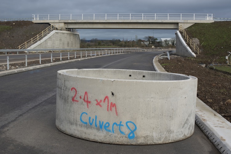
Pic 3: A small stream flows beneath Seapark
roundabout, and is accommodated in a culvert
(seen under construction in March 2014 in this
shot). Now the culvert is completed and
carrying the stream, and this shot shows it
sporting a brand spanking new trash screen on 3
May 2015. A trash screen catches large debris,
like tree branches, that could otherwise get
clogged up inside the culvert. [Alan
Dodridge]
Pic 4: View towards the entrance to the PSNI
station from Seapark roundabout on 3 May 2015.
The PSNI are getting a brand new entrance
building thanks to the need to demolish the old
one to make way for the roundabout. [Alan
Dodridge]
Pic 5: View south west along the offline section
of dual-carriageway on 3 May 2015. Although
practically complete, even down to white lining
and cats-eyes - it remains frustratingly out of
use due to the fact that it terminates at
Seapark roundabout which is still under
construction. [Alan
Dodridge]
Pic 6: View north-east, towards Carrickfergus,
from the centre of the University of Ulster
roundabout on 3 May 2015. All traffic is
currently using the northbound carriageway (on
the left) while the southbound carriageway (on
the right) looks close to completion, albeit
with its final surfacing still having to go
down. The poles are now in place for the traffic
signals that will eventually control this
roundabout which exists as a roundabout
primarily to allow u-turns for landowners along
the route who will no longer be able to turn
right from their driveways thanks to the
continuous central reservation. [Wesley
Johnston]
Pic 7: Same location as previously, but looking
south-west instead, ie towards Belfast, from the
centre of the University of Ulster roundabout on
3 May 2015. All traffic is currently using the
northbound carriageway (on the right) while the
southbound carriageway (on the left) again looks
close to completion [Wesley Johnston]
28 Apr 2015: If
the scheme is on schedule, then we are within
two months of completion. This update is to
bring you three photos which were taken by Shay
Sweetnam from Knockagh hill around two weeks
ago, and show work on the offline section
between Greenisland and Seapark. You can see the
completed Whinfield Lane bridge, and this view
highlights how narrow it is (since it merely
provides access to a handful of properties).
Hopefully the coming weeks will see the scheme
moving towards opening of the new stretches of
road.
The offline section of the scheme seen from
Knockagh in early April 2015. Greenisland is to
the right, and Seapark is on the left with
Whinfield Lane bridge just left of centre. [Shay
Sweetnam]
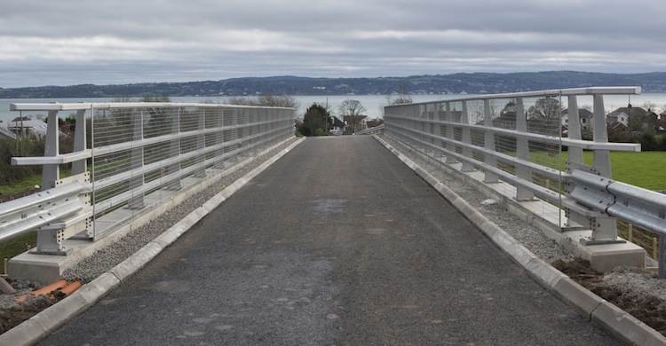
Closeup of Whinfield Lane bridge seen from
Knockagh in early April 2015. Whinfield Lane has
been diverted up onto the bridge which was built
just to the south of the original lane. The
original lane ran to the left of the bridge in
this view, close to the line of trees, and has
now been removed. [Shay Sweetnam]
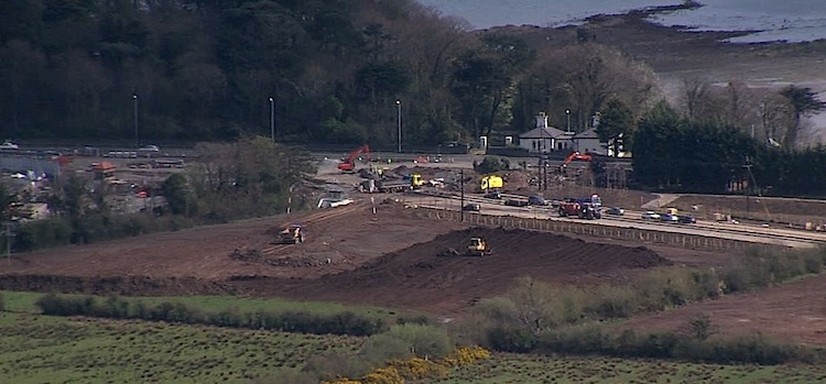
Closeup of Seapark - the very north end of the
scheme - seen from Knockagh in early April 2015.
Behind the trees on the left is the PSNI
station, whose entrance gate has been demolished
to make way for the new roundabout that is
taking shape in the centre of the frame. The
new, as yet unopened, offline section of
dual-carriageway can be seen running to the
lower right, with the house marking the location
of the existing Shore Road which will remain in
situ. [Shay Sweetnam]
11 Mar 2015:
On 5 March we passed the second anniversary of
the commencement of construction. According to a
Question
for Written Answer in the Assembly last
week, this scheme is now due to be completed "in
late summer 2015", which I would take to mean
around August, ie about 5 months from now, so
we're more than 80% completed. The main change
from the point of view of the travelling public
has been the introduction of a contraflow at
Seapark (at the north end of the scheme). This
has meant all traffic using the citybound
carriageway between Trooperslane and the site of
the former entrance to the PSNI station at
Seapark. This former entrance now appears to
have been removed, and has been replaced with an
enormous temporary fence. You can see both this
and the contraflow in this
sequence of pictures taken by Alan
Dodridge on 8th March. These works all permit
the construction of the final roundabout of the
scheme, and indeed the only one that will
operate as a conventional roundabout, ie without
traffic lights. With thanks to Andrew McKeever
for information.
28 Feb 2015:
No photos with this update, but work continues
to advance steadily. In fact, according to a recent
press release, the contractor has now
clocked up half a million working hours.
To put that in perspective, if I had been
building this scheme on my own, even working 12
hours a day, 7 days per week I would have
already spent over 114 years on the site! The
offline section of road between Greenisland and
Seapark (at the PSNI station) is now basically
completed, and only awaiting the completion of
Seapark roundabout - without which is is
inaccessible. This was delayed pending the
decommissioning of the entrance to the PSNI
station (which is inconveniently in the way)
which finally happened around mid February
following the opening of a temporary entrance
onto Trooperslane. Since the Seapark roundabout
is mostly offline (ie off to one side of the
current road) work is likely to be fairly
straightforward. Work is also well advanced on
the citybound carriageway with surfacing going
town around the entrance to the University in
mid February. With thanks to Andrew McKeever for
his observations. Work still seems on schedule
for completion in the early summer.
5 Jan 2015:
The purpose of this update is to bring you
photos of two parts of the scheme. The first is
a set of photos taken on the offline section
around Whinfield Lane by Alan Dodridge on 22
December. They are part of a set of 43 photos on
his
Flickr page, but I reproduce six here with
his permission. They show that Whinfield Lane
bridge is now finally completed, and that the
offline section is also essentially completed
with vegetation planting works going on along
the verges, one of the last tasks. The second is
a set of three photos taken by Andrew Fleming in
mid December showing the site of the future
roundabout at the University of Ulster. Thank
you both! Now for the pics...
Pic 1: View north-east (towards
Carrickfergus) on the offline section of
dual-carriageway between Station Road and
Seapark on 22 Dec 2014. Showing the Whinfield
Road bridge completed. It carries a laneway to
maintain access to properties to the left here.
The huge concrete pipe section in the foreground
may protect an open manhole, or it may just be
lying there, but as I wasn't with Alan I cannot
check! [Alan Dodridge]
Pic 2: View south-west (towards Belfast) from
Whinfield Lane on 22 Dec showing the offline
section of dual-carriageway completed and
surfaced, and presmably just awaiting completion
of the link sections at either end. [Alan
Dodridge]
Pic 3: View south-east across the completed
Whinfield Lane bridge which appears to be in use
on 22 Dec. As you can see, it is only one lane
wide, which is quite sufficient given that it
only gives access to three homes and some
fields. [Alan Dodridge]
Pic 4: View north-east along (towards
Carrickfergus) from Whinfield Lane bridge on 22
Dec showing the offline section of
dual-carriageway completed and surfaced. On the
left some trees have been planted, while on the
right various plants and hedging has been
planted. The gap in the kerbstones in the
foreground is the route of the original
Whinfield Lane, now closed. [Alan Dodridge]
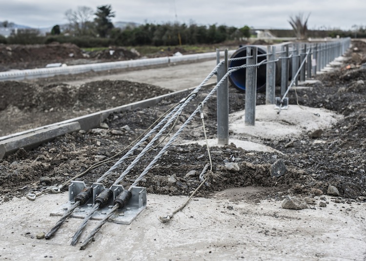
Pic 5: Closeup of the end of a piece of
wire-tensioned crash barrier. You can see how
the cables are anchored to a large concrete
block in the ground and are then passed through
each post. This means that, when impacted by a
vehicle, the stress of the impact is passed
along the cables. This reduces the chances of
the vehicle going clean through the barrier onto
the opposite carriageway, and allows the wire to
remain intact to guide the vehicle to a
controlled halt. Note in particular how the
bottom two cables weave back and forth around
alternate sides of the posts. 22 December 2014.
[Alan Dodridge]
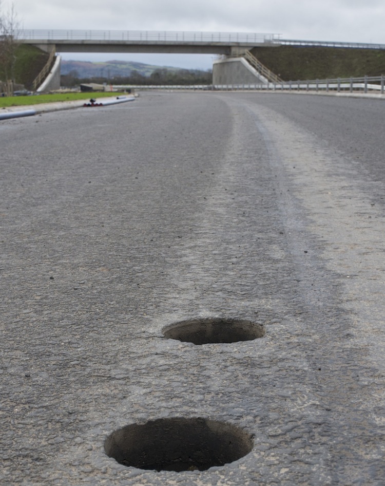
Pic 6: Two holes in the road surface near
Whinfield Lane. These are roughly 10cm across
and mark where samples of tarmac have been
removed after laying. This is a routine
procedure: the samples will be taken to a lab to
be tested to confirm that the tarmac has been
laid to the required standard. The holes will be
filled in. 22 December 2014. [Alan Dodridge]
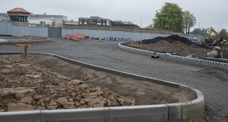
The site of the future roundabout at the
University of Ulster on 16 December 2014,
showing all traffic passing round the inland
side of the future roundabout. Taken from the UU
entrance road with the passing cars on the Shore
Road. The lorry is parked on the future
citybound carriageway which is still a worksite
as it is being reconstructed. [Andrew Fleming]
This view north-east towards the site of the UU
roundabout shows more clearly how all vehicles
are currently passing round the inland side of
the future roundabout. When finished both
lanes shown here will be countrybound and where
the PSNI vehicles are will be a signalised
roundabout. 16 Dec 2014. [Andrew Fleming]
Looking south west, the opposite direction to
the previous photo, this is the point where the
upgraded road ties into the existing four lane
Shore Road towards Whiteabbey. On the left is
Loughshore Park and the road is being resurfaced
after the kerb has been realigned. The bus
turning circle that used to be here seems to
have disappeared. 18 Dec 2014. [Andrew Fleming]
23 Nov 2014:
Three weeks ago, on 2 November 2014, Alan
Dodridge took a set of 15 photos showing various
locations along this scheme. He has put them all
online here, but I reproduce five here
with his permission (thank you). Sorry for the
delay, which was due to the pressures of life!
Pictures 1 and 2 show similar views looking
north-east along the Shore Road from close to
Shorelands. They show the original Shore Road on
the right, now out of use (except for access to
properties). On the left is the future
northbound carriageway, now completed and
temporarily carrying all traffic. Work is now
well underway here to reconstruct the original
Shore Road to become the future southbound
carriageway, a job that should not be as
time-consuming as building the northbound
carriageway since a road is already here and
less significant earthworks are required. The
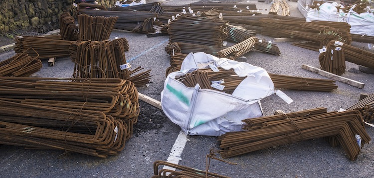
third picture shows lots of steel reinforcing
bars (rebar) being stored on site, suggesting
further retaining structures are still to be
built. The fourth picture shows the Station Road
junction in Greenisland. This will eventually be
a signalised roundabout, but for now all traffic
is being diverted round the north-western side
of the future roundabout via the rather awkward
curve shown here. The final picture shows the
point where the on-line section of the Shore
Road diverts through the site of the former Spar
shop onto the offline section. The offline
section is largely completed, but not yet open
since its terminus at Seapark (ie the police
station) is not yet completed. In this photo, it
looks as if the cars are heading off onto the
online section, but they are actually diverted
back through the works along the line of cones,
back onto the existing Shore Road. On the
offline section, the last I heard was that the
road deck is now being constructed on the
Whinfield Lane overbridge, which will soon allow
Whinfield Lane to be diverted onto the bridge.
Construction of the Seapark terminus - to be a
conventional roundabout - requires a temporary
entrance to be built for the police station onto
Old Shore Road here.
To ensure fast access onto the Shore Road from
this temporary entrance for emergency vehicles,
it has required the installation of traffic
signals on the Shore Road at Trooperslane. These
may be intended to be temporary, but don't be
surprised if they become permanent now that the
DRD has gone to all the trouble of building
them! The scheme is now seven months away from
its expected completion, and so far progress
seems to be in line with this timetable.
Pic 1: View north-east along Shore Road on 2
November 2014 with all traffic using the
completed northbound carriageway on the left,
while the old road on the right is reconstructed
to become the future southbound carriageway.
[Alan Dodridge]
Pic 2: Similar view to Pic 1, looking north-east
along Shore Road on 2 November 2014, but this
time taken from the old road that is now closed
(except to allow access for residents). [Alan
Dodridge]
Pic 3: Lots of no-nonsense steel reinforcement
bars lying in wait, presumably to become part of
concrete structures such as retaining walls.
[Alan Dodridge]
Pic 4: View north-east along Shore Road at the
Station Road junction in Greenisland on 2
November 2014. The photographer is on the old
road, now closed, while all traffic uses the
future northbound carriageway on the left. The
junction ahead will eventually be a signalised
roundabout but for now is operating as a
standard signalised T-junction. [Alan Dodridge]
Pic 5: View north-east along Shore Road,
Greenisland, at the point where the completed
dual-carriageway will head off inland (on the
left). Vehicles are driving on the first hundred
yards or so of the offline section, but are then
being diverted along behind the cones back onto
the old Shore Road again, on the right ahead.
[Alan Dodridge]
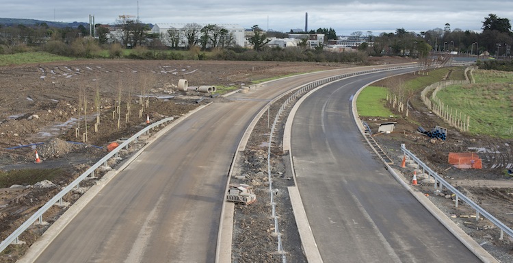
31 Oct 2014:
A second section of the new northbound
carriageway opened to traffic last night (30
October). This is the 500 metre stretch from
Shorelands to Station Road - the section from
the University of Ulster to Shorelands opened in
late July. This means that for the entire
"online" section of the scheme, all traffic is
now using the new northbound carriageway, while
the southbound carriageway is built. (You may
find the maps further up this page useful if
you're not familiar with the scheme.) The
offline section of dual-carriageway between
Station Road and Seapark is largely completed,
but not yet opened as it has not yet been tied
into the existing road at either end. The scheme
still seems to be on course for completion in
June 2014. With thanks to Andy Boal and Andrew
McKeever who let me know about this opening last
night.
14 Aug 2014:
The new section of northbound carriageway opened
on or before 24th July as anticipated in the
last update. The three photos below were taken
by Owen Fulton on 28 July 2014 (only being put
up now as I was on holiday) and show traffic
using the new northbound carriageway from the
start of the scheme close to the University of
Ulster to around 500 metres before the Station
Road junction. If you are affected by the
scheme, don't forget to bookmark
the official site for daily details of
traffic arrangements.
Traffic using the future northbound carriageway
on 28 July 2014, but still passing straight
through what will be the future roundabout at
University of Ulster (seen here). [Owen Fulton]
View north-east along Shore Road from around
Neill's Lane showing traffic using the future
northbound carriageway on 28 July 2014. The road
on the other side of the central reservation was
in use until the switchover and will now be
reconstructed to become the southbound
carriageway. Note the telegraph poles still
in-situ in the central reservation - these will
presumably be removed. [Owen Fulton]
View south-west along Shore Road from near
Shorelands showing the same stretch of road in
the previous photo, but from the opposite end.
The road in the foreground was carrying all
traffic until late July, and will now be
reconstructed to become the southbound
carriageway. It appears to be still partly in
use, presumably to retain access to properties.
[Owen Fulton]
16 Jul 2014:
This update includes photos taken about two
weeks ago by Owen Fulton. The first four photos
show that the northbound (Carrick-bound)
carriageway of the new dual-carriageway largely
complete from the University of Ulster at the
south end up to around Shorelands, ie about 500
metres before you reach Station Road in the
middle of Greenisland village. Since these
pictures were taken road markings have been put
down on this carriageway, suggesting that all
traffic will be shifted over onto it in the near
future, and I am told that this will be on 24th
July. This will allow the future southbound
carriageway to be built. The 500 metre stretch
of northbound carriageway between Shorelands and
Station Road is less advanced, suggesting
traffic won't divert onto it quite as soon. Work
has started on the two roundabouts at Station
Road and Shorelands, with traffic off to one
side to facilitate this. The fifth picture shows
the start of the new offline section of
dual-carriageway (ie where the new road is being
built through open countryside leaving the
existing Shore Road unchanged), showing that
this too is coming on well. In terms of
junctions, the new roundabout at the University
of Ulster is well advanced, but still not
functioning as a roundabout. The offline section
of road itself, seen in the last photograph,
seems to be largely completed except that there
is still much to be done at the fourth (and
last) roundabout that will re-join it to the
existing Shore Road at the police station at
Seapark. The project has been underway now for
16 months with about 11 months left to run, and
seems to be on schedule. With thanks to Owen
Fulton, Andy Boal, Ciaran O'Flaherty and Philip
Griffiths for information for this update.
Pic 1: View north east along the future
northbound carriageway at Langley Hall, circa 30
June 2014. This is the same
view before work began. [Owen Fulton]
Pic 2: Just a short distance beyond the previous
image, this is the view north east along the
future northbound carriageway at Silverstream
Banks, circa 30 June 2014. This is the same
view before work began. [Owen Fulton]
Pic 3: Moving on to Neills Lane, and turning
round this is the view along the future
northbound carriageway looking south west
towards Belfast on circa 30 June 2014. This is
the same
view before work began. [Owen Fulton]
Pic 4: At Shorelands, traffic has now been
diverted into a circular path around the site of
the future roundabout which will presumably now
get underway. This is the view north west from
the Shore Road along Shorelands, seen circa 30
June 2014. This is the same
view before work began, showing how the
large earth bank has been cut back and replaced
by the huge retaining wall. [Owen Fulton]
Pic 5: View north east from Shore Road onto the
future northbound carriageway of the offline
section of road, circa 30 June 2014. For those
who remember it, this used to be the car park of
the Spar shop - now demolished, but with the
advertising signage still in place, as you can
see in this
photo of the car park before work began.
[Owen Fulton]
Pic 6: The offline section of road is very
advanced as seen here looking south west (ie
towards Belfast) from Whinfield Lane circa 30
June 2014. Since the last update in April, the
road surface has been laid on almost this entire
stretch. The bridge (which will carry the
diverted Whinfield Lane) has had its two beams
in place since March, but nothing much seems to
happened since then. [Owen Fulton]
21 Apr 2014:
Ten days ago, on 11 April, I had the privilege
of site tour of the A2 Greenisland scheme. I am
indebted to Roy Spiers, Basil Hassard and Hamish
Bennet for giving me their time, for access to
various parts of the site and for explaining
everything in such detail - thank you. One
benefit of the visit is that I was allowed to
take pictures, ten of which I am sharing here -
you will see from the pictures below that I was
able to see the huge amount of progress on the
offline section north of Greenisland village,
where the tarmac road surface is being put down
in one location. I was also shown the online
section south of and through Greenisland
village, where the stone road base for the
future northbound carriageway is now in place in
several locations. The whole scheme seems to be
on schedule. The pictures below are arranged in
order from south to north (Belfast end to
Carrickfergus end).
Pic 1: Looking north east along the future
northbound carriageway, just south of
Shorelands, on 11 Apr 2014. Although this just
looks like a general works site, this is
actually the precisely-laid gravel road base
over which tarmac will be laid. The blue rods on
the right with the yellow tops are used for
accurately measuring the level of the gravel to
ensure it is flat. Same
view before work began. [Wesley Johnston]
Pic 2: The view along 'Shorelands' on 11 Apr
2014 towards the Shore Road. Work has begun here
to construct the signalised roundabout that will
replace the existing T-junction. Traffic on
Shorelands has been shifted to the left. A large
number of electrical, water and gas cables are
being excavated and relocated. Same
view before work began. [Wesley Johnston]
Pic 3: View north east along Shore Road north of
Shorelands on 11 Apr 2014. Work here is not
quite so advanced as above - the cables and
posts, for example, still have to be moved. In
the foreground are new retaining walls being
built for the houses on the left, most of which
are owned by DRD. Similar
view before work began. [Wesley Johnston]
Pic 4: View south west towards the Station Road
/ Shore Road junction on 11 Apr 2014 - barely
visible behind the yellow sign. This is taken
from the northbound carriageway of the offline
section of the road, where the Spar shop used to
be, from roughly here.
The road base is well advanced here, and on the
rest of the offline stretch. [Wesley Johnston]
Pic 5: Heavy plant machinery being used to lay
tarmac on the offline stretch near Greenisland
on 11 Apr 2014. The tarmac was being laid in two
or three layers, depending on the location.
[Wesley Johnston]
Pic 6: Road roller compacting freshly laid
tarmac on the offline stretch on 11 Apr 2014.
Note the holes in the far kerb - this is special
kerbing which doubles as a drainage duct,
negating the need for conventional metal grilles
in the road surface. It was previously used on
the A20
Newtownards Southern Distributor. [Wesley
Johnston]
Pic 7: View south west along the offline stretch
of dual-carriageway from Whinfield Lane bridge
on 11 Apr 2014. [Wesley Johnston]
Pic 8: The new Whinfield Lane bridge had its two
beams in place on 11 Apr 2014, and the approach
embankments largely built up. The next step will
be to add the bridge deck and then construct the
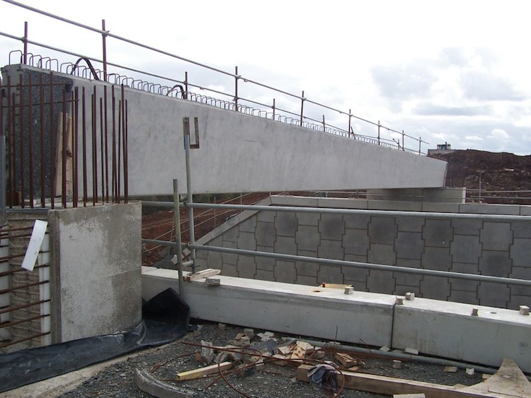
road over the top. [Wesley Johnston]
Pic 9: View north east from Whinfield Lane
bridge on 11 Apr 2014. The existing Whinfield
Lane can be seen running left-right in the
foreground and is still in use by the private
residents of the lane. [Wesley Johnston]
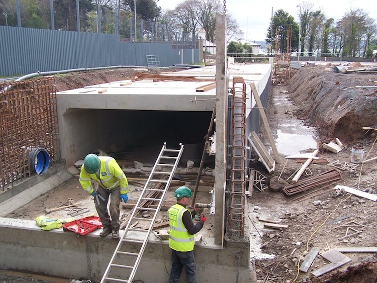
Pic 10: At the very north end of the scheme, at
Seapark, this large culvert was being
constructed on 11 Apr 2014. It will carry a
stream which, thanks to the dry weather, can
currently be accommodated in the pipe running
along the wall on the left! [Wesley Johnston]
The exact design of the road will depend on the
location. The "offline" section would see the
road built to rural dual-carriageway standard
with a total width of 27 metres. The "online"
section would reduce this to 22 metres to ease
the impact on properties. Local traffic will
only be permitted to turn left on and off the
road except for a few key junctions. People who
wish to turn right from driveways will turn left
and then turn round at the next junction. The
junctions will all be traffic-light-controlled
roundabouts which perform better than the more
basic priority roundabouts when the main flow of
traffic is "straight on". The road will have a
40mph speed limit. Other options such as
building the offline option in a cutting to
reduce noise were rejected as they would require
even more land. Possibilities of building the
road through the grounds of the University of
Ulster and through the sea on a causeway were
also rejected.
A person who lives on the route told me that
the Roads Service had in years gone by explored
the idea of building the road on the sea side by
reclaiming the beach, but that this idea was
abandoned after uproar from the residents. This
was tried in Whiteabbey, where the A2 was moved
onto the beach, and it has had a very negative
effect on the shoreline area. Widening the A2 through
Greenisland is also destructive, and so most of
the residents seem to prefer the inland option
which would re-route the road about 200 metres
inland and leave the Shore Road intact. The
Public Inquiry is likely to be a lively affair.
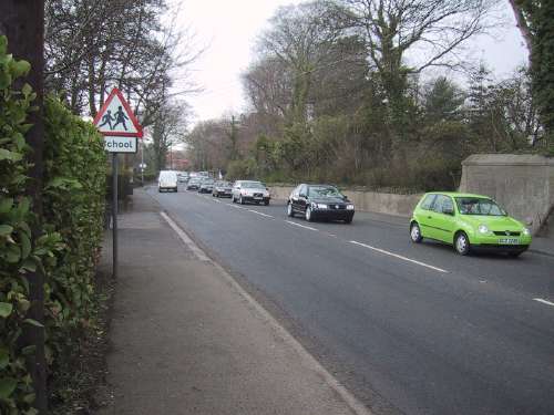
Photos From Before Work Began
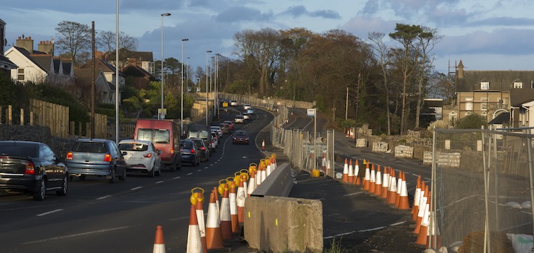
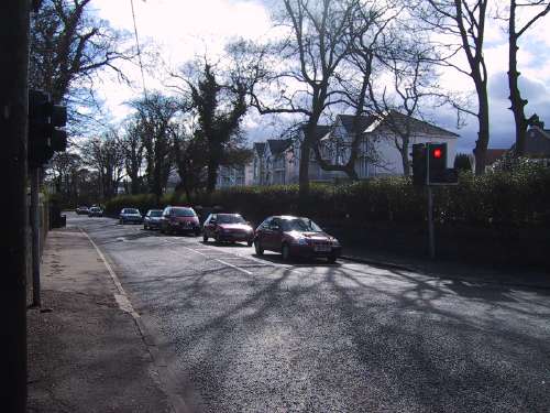
Part of the daily
evening traffic jam on the 2 lane section of the
A2 approaching Greenisland. [Photo by Wesley
Johnston]
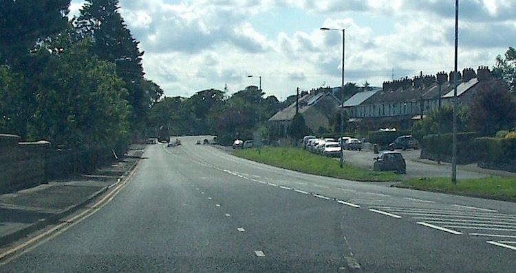
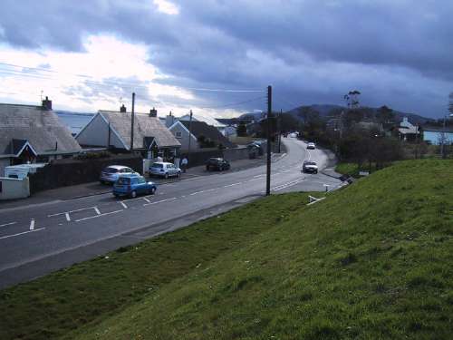
At the centre of the
village, the number of mature trees and large
houses close to the road is apparent. This
picture was taken in winter when the trees were
bare, but the road looks well in summer. [Photo
by Wesley Johnston]
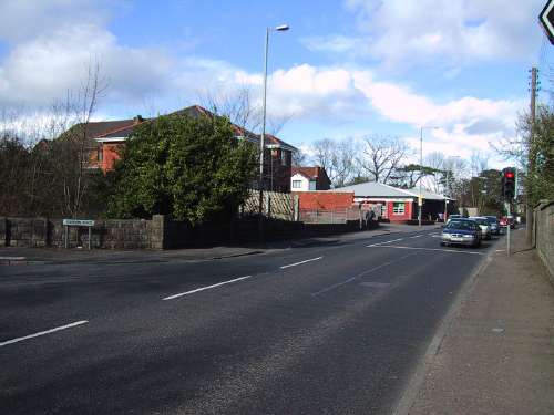
The A2 running through
the centre of Greenisland village. [Photo by
Wesley Johnston]
Another
view of the A2, looking back to Belfast showing
the houses at the shore. More recent housing
developments, such as the one off frame to the
right, were built with the widening in mind, as
you can see from the wide grass verge. [Photo by
Wesley Johnston]


