|
|
Status
|
Construction scheme
(completed) |
|
Contractor
|
Duo Operations Ltd,
Augher (www.duoplc.com)
|
|
Where
|
To
construct a road link from the A57
Templepatrick Road to the west of
Ballyclare to the B94 Rashee Road north
of Ballyclare via the B95 Doagh Road. |
|
Total
Length
|
3.2 km / 2.0 miles
|
|
Dates
|
Road has been proposed
since 1980s
Included in draft
Belfast Metropolitan Area Plan - 2004
27 August 2009 - KPL
announce plans to proceed
Planning permission
granted - 11 Jan 2011
Scheme on hold (as of Mar 2012)
KPL Group placed into
administration - Feb 2014
Neptune Group acquire land and indicate
a desire to proceed with the road - Nov
2015
(Previously due to
commence Feb 2012 as of Dec 2011; "after
Mar 2011" as of Aug 2010; August 2010 as
of May 2010)
Roundabout at A57 and
100 metres of relief road completed -
mid 2018
Planning permission
for southern section of relief road
granted - November 2019
Construction on section around Doagh
Road began - spring 2020
Planning permission
for northern section of relief road
granted - 27 April 2021
Work on Phase 1 Doagh Road to
Templepatrick Road began - Jan 2021
Roundabout on Doagh
Road completed - Aug 2021
Work on Phase 2 Doagh Road to Rashee
Road began - Sep 2021
Phase 1 opened to
traffic - 21 Dec 2021
Phase 2 opened to
traffic in 20 Jan 2023
|
|
Cost
|
£13m - funded by
private developer (as of 2023) of which
£4.5m for the Doagh Road to
Templepatrick Road stretch.
|
Click here to
jump straight down to updates for this
scheme.
Area plans have marked Ballyclare as a town for
significant growth to accommodate some of
Northern Ireland's fast-growing population.
However the town has historically been severely
limited by the fact that the only way to get
from the north of the town to the south, and
hence to Belfast, is via the congested main
street. This scheme has not necessarily diminished
the traffic on the main street, but it has
allowed continued housing development in the
town without increasing congestion at
that location. It sees a new two-lane road link
running round the north west of the town
connecting the A57 Templepatrick Road to the
west of Ballyclare to the B94 Rashee Road north
of Ballyclare via the B95 Doagh Road. This
included a second bridge over the Six Mile
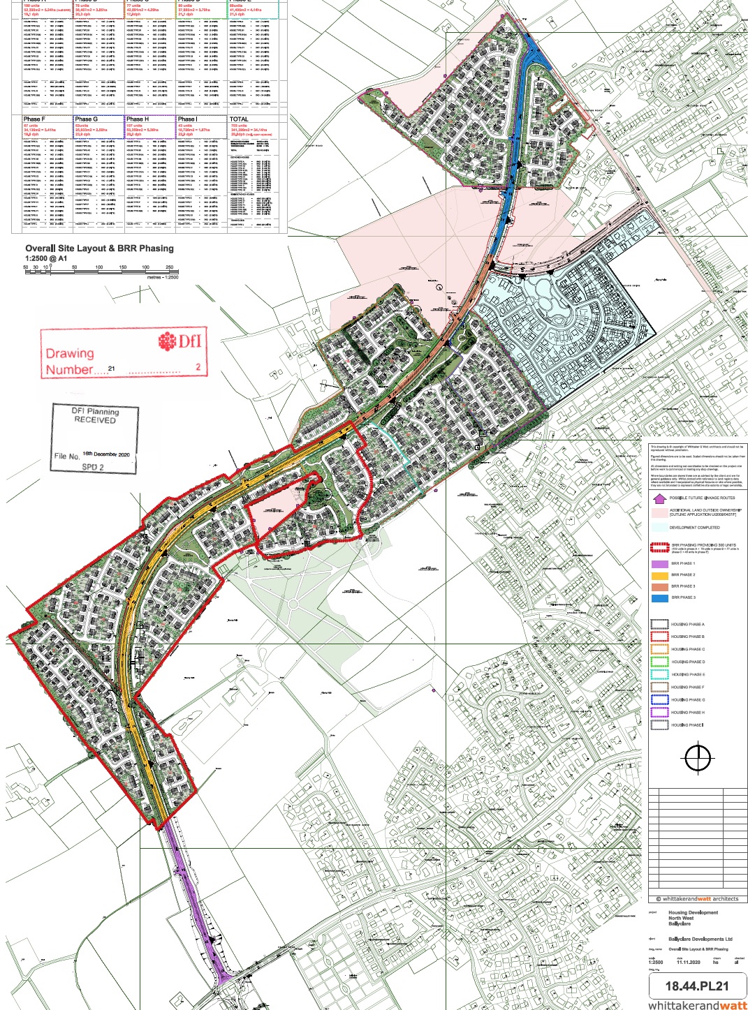
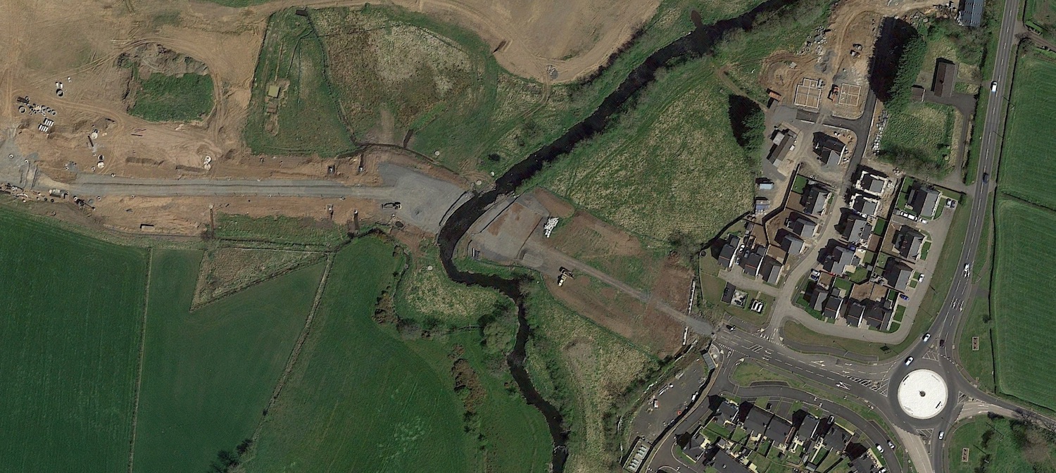
Water. The route is shown below.
The proposal had been on
the cards for about 40 years when it was
completed, and had been included in the Belfast
Metropolitan Area Plan 2015 (first published
2004). Construction of the road was always
planned to be carried out by private developers,
but it was not until August 2009 that a
developer - KPL Group - secured sufficient land
to announce its construction which the
Ballyclare Gazette described
as "the largest and most expensive privately
funded road proposal ever brought forward in
Northern Ireland". The road was needed in
order to begin work on a major housing
development which will take up to 20 years to
complete and include between 1000 and 2000 homes
when completed. KPL subsequently disappeared but
a new developer, Neptune, took up the reins and
continued the work.
Route
The
route is a single-carriageway made up as
follows:
- A new roundabout on the A57 Templepatrick
Road at the existing Ballyrobert Road junction
(completed 2018).
- Approximately 1km of road going north-west
to a new roundabout on the B95 Doagh Road,
adjacent to the cemetery. This stretch will
include a bridge over the Six Mile Water
(completed 2021).
- Approximately 2km of road running in an
S-shape to a new roundabout at Rashee Road
just south of the existing Cogry Road
junction.
Note that this route
differs slightly from that proposed in the
Belfast Metropolitan Area Plan in that the
northern section runs further out from the town
than envisaged in that document.
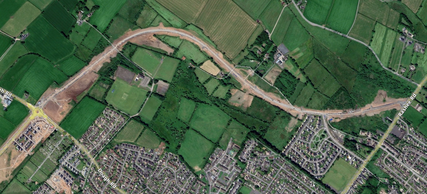
The map below shows the route of most of the
scheme, the stretch from Doagh Road to Rashee
Road. The southernmost section of the scheme
(Templepatrick Road to Doagh Road) is not shown.
Updates
25 Jan 2023: Phase 2 of the Ballyclare
Western Relief Road was officially
opened by the Mayor of Antrim and
Newtownabbey on a snowy morning on Friday, 20th
January. This marks the completion of the road
which has been in planning for approximately 40
years. Congratulations to the Neptune Group and
also to the contractor, Duo Operations Ltd.
While the road is officially the B56, naming
rights fall to the council so it remains to be
seen whether it will also be named "Jubilee
Road", as phase 1 was, or whether it will be
given a new name. A great job and a boost for
Ballyclare. The total cost of both phases is now
given as £13m, slightly more than the £11m
estimated in 2021.
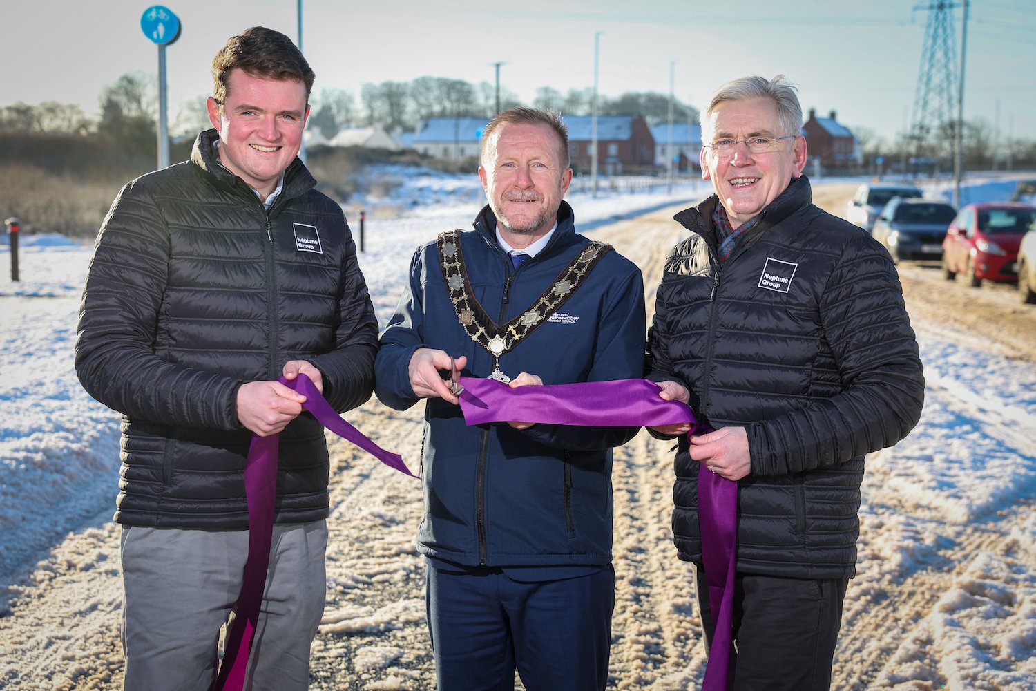
Mayor of Antrim and
Newtownabbey Stephen Ross with two Neptune Group
representatives at the official opening of phase
2 on 25 January 2023.
4 Jan 2023: Phase 2 (of 2) of the
Ballyclare Western Relief Road is now in its
final days! At the end of December the developer
confirmed that they were planning to open
the road by "mid January". Once open, the
road will remain the responsibility of the
developer for the first year in case there are
any defects, after which it is assumed that DFI
will "adopt" road and it will become part of the
public road network. Phase 1 was named Jubilee
Road by the local council. It's not clear if
Phase 2 will be bear the same name. However, the
new road will take the number B56. With thanks
to Andy Boal for spotting that.
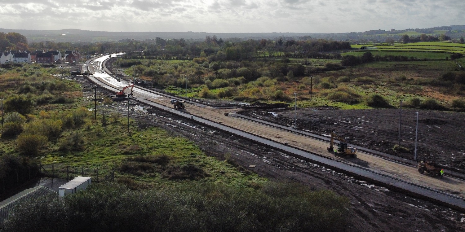
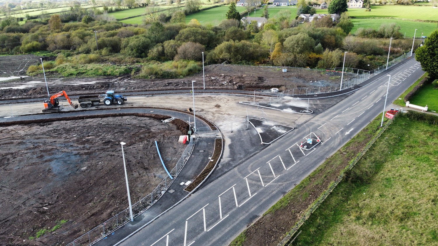
27 Oct 2022: This update is primarily to
share some photos that I took yesterday with my
newly-acquired drone! They show that progress on
phase 2 (the final phase) of the road is
excellent, with the final surface, footways and
street lighting in place along much of the road.
Some surfacing is still underway at the Doagh
Road and Rashee Road ends, but it does look
likely that the road will be completed by the
end of 2022 as was anticipated when work began
in September last year. The photos also show
what a major scheme this is, at least for one
that is entirely developer-funded. The photos
are arranged from the south end (A57
Templepatrick Road) to north end (B94 Rashee
Road).
Pic 1: View south along the new road towards the
southern terminus of the scheme at the A57
Templepatrick Road. This section was built in
phase 1 and was completed in December 2021. 26
Oct 2022 [Wesley Johnston]
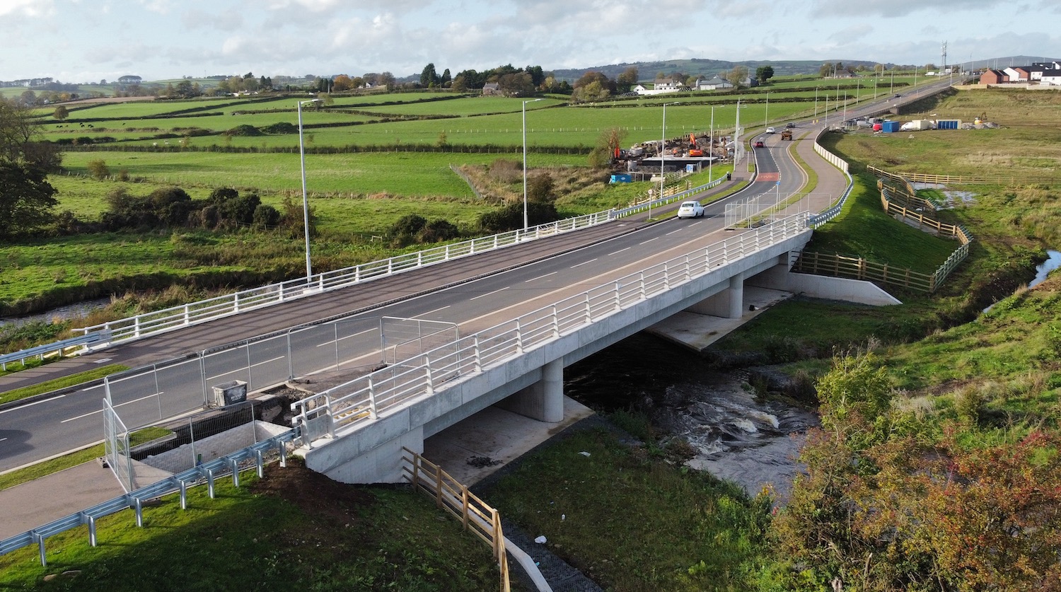
Pic 2: View north from the same location as pic
1, this is the bridge over the Six Mile Water
that opened to traffic in December 2021. The
road is currently open as far as Doagh Road.
Note some kind of underground cambers buing
retro-fitted in the abutments of the bridge.
Possibly storage chambers for drainage? Or
possibly inspection chambers. 26 Oct 2022
[Wesley Johnston]
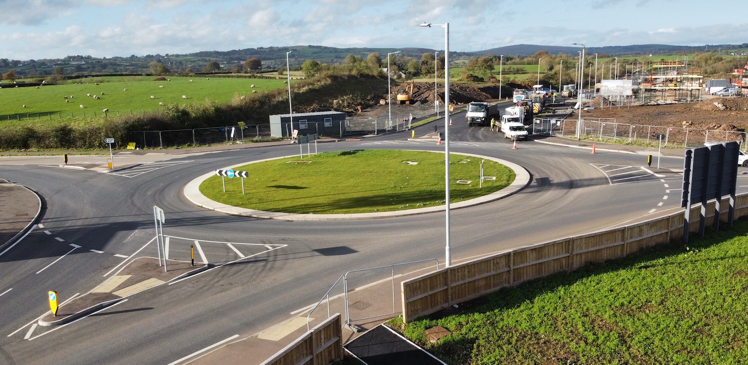
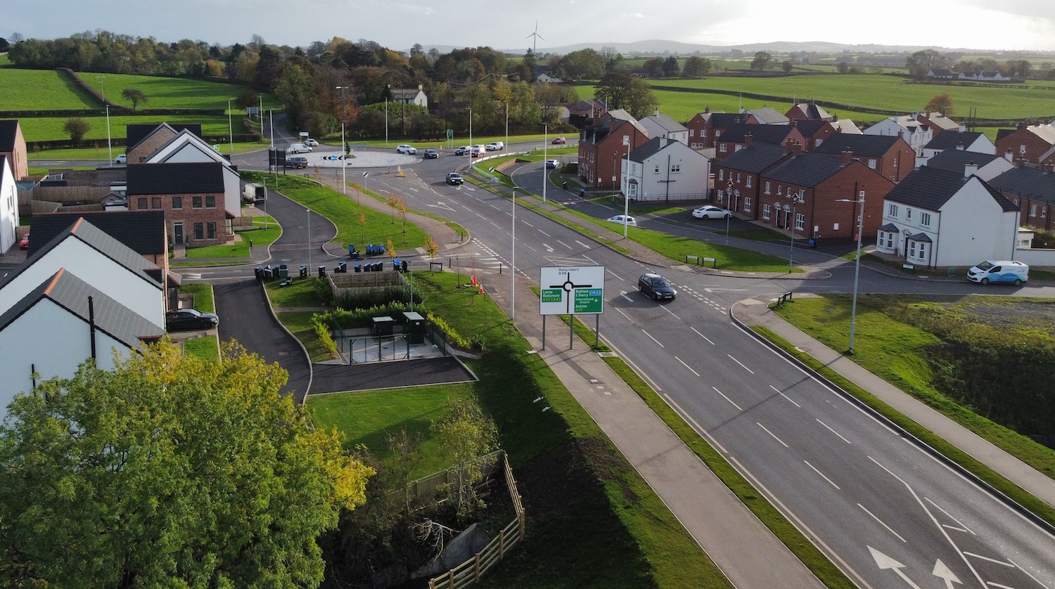
Pic 3: The Doagh Road roundabout seen looking
north on 26 Oct 2022 with Doagh Road going from
left to right. This roundabout opened in
December 2021. Phase 2 of the scheme is visible
ahead, with surfacing work apparently underway.
[Wesley Johnston]

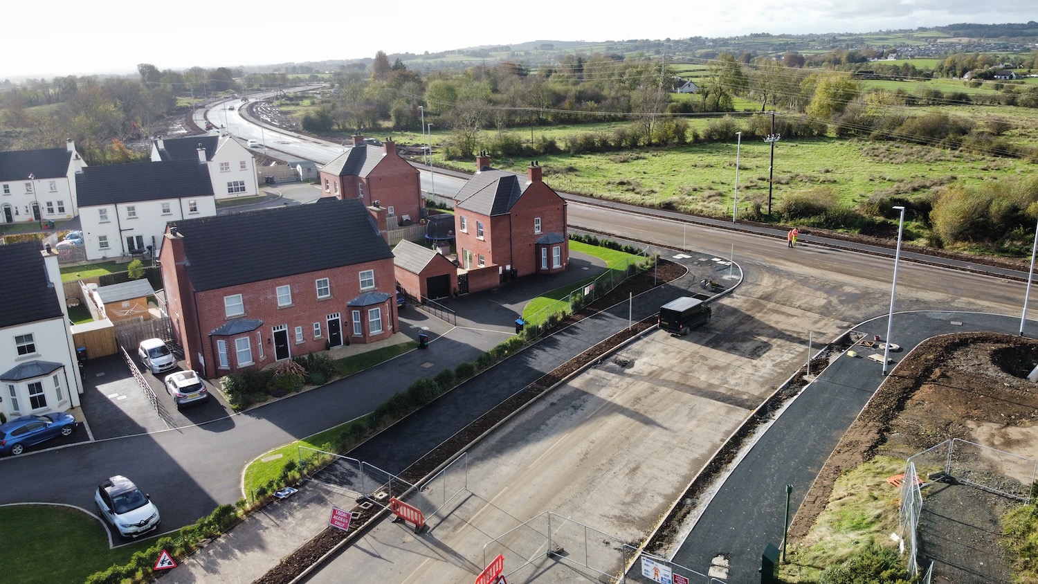
Pic 4: Part of Phase 2 of the new road seen from
near Ballyclare RFC on 26 Oct 2022, looking
towards Doagh Road roundabout. Work is already
underway on new homes on the upper left. [Wesley
Johnston]
Pic 5: Part of Phase 2 of the new road seen from
near Ballyclare RFC on 26 Oct 2022. You can see
how the footways and lighting are in place, and
the topsoil between the footway and the
carriageway placed and ready for seeding (which
might wait until the spring). The T-junction
here is one of many that will serve new areas of
housing that will extend along both sides of the
new road. [Wesley Johnston]
Pic 6: Moving north again, this is the future
junction of the new road with Reader's Park,
seen on 26 Oct 2022. No more new houses are
planned at this exact spot, so the fields ahead
will remain as they are now. [Wesley Johnston]
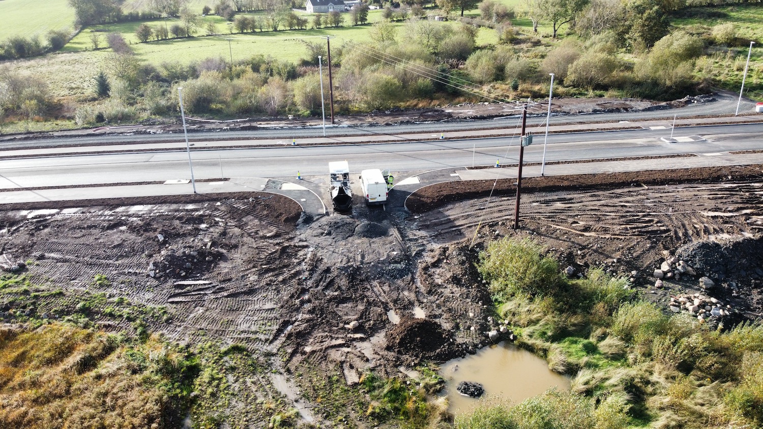
Pic 7: View from Rashee Road looking south-west
along the new road on 26 Oct 2022, with the
houses seen in pic 6 visible on the left in the
distance. Work on the footways and surfacing
does not seem completed here yet. Most of the
land visible here is earmarked for new housing.
[Wesley Johnston]
Pic 8: Terminus of the new road at Rashee Road,
on 26 Oct 2022. This was previuously planned as
a roundabout but has been built as a priority
T-junction with a pair of left-turn filter
lanes. This will likely perform fine as Rashee
Road is not very heavily trafficked and
visibiliy is good. Localised widening of Rashee
Road took place here during the summer. Street
lighting is already in place. [Wesley Johnston]
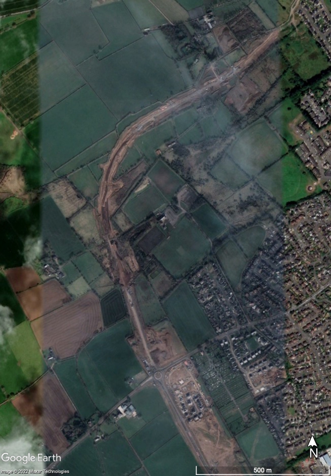
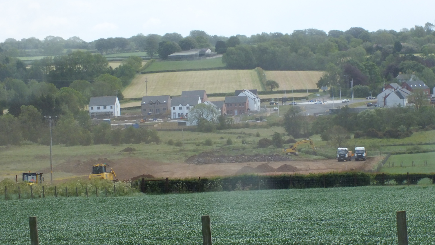
14 Oct 2022: The contractor is working
steadily along the entire length of the second
phase of the road and it looks to me as if the
entire thing really will be completed in one go,
currently anticipated before the end of the
year. This is how developer-led road schemes
SHOULD progress, something that other local
councils should learn from. (I'm looking at YOU
Larne
West Distributor.) The Google Earth image
that I have reproduced below appears to have
been taken at the end of the summer and shows
how well works were progressing even then. Once
this road opens it will make a significant
difference to the town. Phase 1 (Doagh Road to
Templepatrick Road) is already making a
difference, and this week was officially
named Jubilee Road, in honour of the late
Queen Elizabeth II, by the local council.
Google Earth shot of phase 2 of the road under
construction in later summer, 2022. North is
towards the upper right corner. [Google Earth]
10 Aug 2022: Rashee Road (the northern
terminus of the scheme) was closed for a number
of weeks to allow construction of the new
T-junction that will terminate the new road. The
road has recently re-opened and the picture
below, with thanks to Jim Hanna, shows how it
now looks. Rashee Road has been widened to allow
the provision of a right-turn pocket. The new
junction will operate as a priority T-junction
(i.e. without traffic signals). The whole road
is anticipated to be completed by the end of
2022.
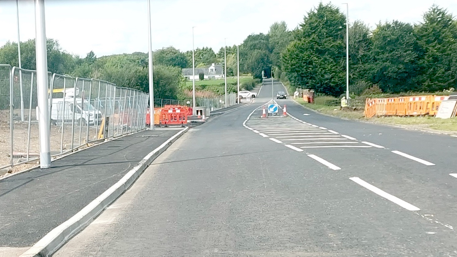
View north along Rashee Road, Ballyclare on 9
August 2022 showing the terminus of the future
Ballyclare Western Relief Road on the left [Jim
Hanna].
29 Jun 2022: DFI granted planning
permission on 20 May for 699 homes around
the northern part of the Ballyclare Relief Road.
Permission for the northern part of the road
itself was granted in April 2021, and work got
underway in September 2021. It is very difficult
to get a vantage point to see the works as they
are almost entirely offline away from existing
roads. However, the Google Earth imagery below
dates from April 2022 and clearly shows work
well underway along virtually the whole stretch
with kerbing evidently in place in at least two
locations (near Templepatrick Road at the bottom
and in the central section). These are what the
developer is referring to as "phase 1" and
"phase 2" of (4 phases of) the northern part of
the road in the map above. The developer had
previously indicated that the whole road would
be completed by the end of 2022, which seems
plausible though this date has not been
confirmed recently. If anyone is in the area and
wants to send me photos, or to Tweet photos, of
this scheme it would be really appreciated!
Google Earth image from April 2022 showing work
underway from the Templepatrick Road roundabout
(near the bottom) northwards towards Rashee
Road.
21 Dec 2021: Phase 1 of the Ballyclare
Western Relief Road (Templepatrick Road to Doagh
Road) was officially opened by the contractor
this morning. Congratulations to all involved,
including the developer Lotus Homes. This phase
cost a total of £4m, provided privately. You can
see a photograph taken at the opening on
Twitter here, taken on the new bridge over
the Six Mile Water. Work on the longer phase 2
is ongoing, and is expected to be complete
within the next year.
29 Nov 2021: It has now been confirmed
that work started on Phase 2 of the road (Doagh
Road to Rashee Road) in September 2021 and that
it is anticipated to be completed by autumn
2022. Meanwhile, the bridge over the Six Mile
Water is close to completion and is still
expected to open before Christmas. Fellow road
enthusiast Fred Fisher spotted that the parapet
railings were in place on the bridge on 3
November. Finally, I recently found a video
of the beam lift for the bridge, taken in
September.
18 Oct 2021: Phase 1 of this road, the
A57 Templepatrick Road to Doagh Road stretch, is
progressing very well. The new roundabout on the
Doagh Road opened to traffic during August. The
bridge is largely completed and work on
completing the road itself between the two
roundabouts is well advanced. Work was due to be
completed by the end of November, and with
current progress looking good it seems likely to
me that it will be in use before Christmas.
Meanwhile, the media recently reported
that Neptune Group - the developer building the
road - has said it will complete the entire
relief road by the end of 2022 at a total cost
of £11m. To complete it in that timescale (14
months from now) would require work to begin
pretty soon, but planning permission was granted
in April 2021 so there are no obstacles to that
happening. A very interesting time for
Ballyclare.
22 Aug 2021: Work on the A57
Templepatrick Road to Doagh Road stretch of the
scheme has been underway now for eight months
progress is becoming evident. In the Google
Earth picture below, taken in the spring, you
can already see the road base and work underway
on the abutments for the new bridge over the Six
Mile Water. Much has happened since this picture
was taken, and the bridge beams seem to now be
in place and the deck was poured in early
August. This stretch of the road is due to be
completed by November so we could well see it
open by Christmas. Of course, work still has to
be carried out on the rest of the road. As is
often the case with developer-funded roads, this
one looks as if it will be built in at least
four phases, so completion is still some way
off. With thanks to Fred Fisher for information
and photo for this update.
Google Earth shot of the southern part of the
new road, dated 24 April 2021. North is to the
top left. It shows the main A57 on the right
with the existing roundabout. You can then see
the road base being formed, and in particular,
the work on the foundations of the abutments for
the new bridge over the Six Mile Water. [Google
Earth]
View looking north west towards the new bridge,
on 10 August 2021. The tall machine is a
concrete pumping machine which is doing a "deck
pour" to form the deck of the new bridge atop
the bridge beams. [Fred Fisher]
5 May 2021: A brief update to say that
planning permission for the remainder of the
scheme (everything north of Doagh Road) was granted
on 27 April 2021. At the minute work is underway
on the southern stretch of the road (Doagh Road
to the A57 Templepatrick Road) Google Earth have
recently uploaded imagery of the area from
February 2021. This shows that, at that point,
earthworks were evident at the site of the
future bridge over the Six Mile Water, and
hardcore had been laid at the Doagh Road end of
the road.
4 Apr 2021: With work now progressing on
phase 1 of the scheme (Templepatrick Road to
Doagh Road), some more information has now
appeared on the planning portal showing the
route of the remainder of the scheme (Doagh Road
to Rashee Road). I have included a copy of this
map above for reference. This part of
the scheme has yet to begin. In the previous
update (below) I expressed hope that the
northern part would be built in a single phase,
but alas this does not seem to be the case. In
fact, it now appears that it will be built in
four phases starting at the Doagh Road and
working north. These four phases are coloured
purple, yellow, orange and blue in the map
above. However, it should be noted that a
through-route will be available after the orange
phase is completed, via Readers Park. It is
likely that progression of the phases will be
related to the speed of construction of the new
houses, so it's not possible at this point to
put a timescale on its completion, which could
well be a number of years away. The map is quite
detailed (search the planning portal for
application LA03/2020/0881/RM if you want to see
it) and allows us to get an idea of what it will
be like to use. I show a small section below in
more detail.
Close-up of the design of part of the Ballyclare
Western Relief Road showing that it will consist
of one lane in each direction separated by
continuous central hatching that will be used to
allow right-turn pockets into housing
developments and central islands to assist
pedestrians. Note that the road will have no
direct frontage, with houses that face the road
instead having their own service road running
parallel to it. Dedicated bus lay-bys are also
provided for and it is intended to be tree-lined
for much of its length.
22 Dec 2020: The Newtownabbey Times reported
on 11 December that the DFI Minister has decided
to approve planning permission for the northern
section of the Ballyclare Relief Road (Doagh
Road to Rashee Road). I am not certain how this
translates into actual planning applications,
but I do note that a planning application
referring to this section of the road seems to
have been submitted
five days later on 16 December
(LA03/2020/0881/RM), but as yet there are no
associated documents to look at. The original
plan, about 15 years ago, was to build the
entire road in one go. The developer seems to
have been pushing to build the road in at least
two phases, which seems to be borne out by the
work that's underway on phase 1 (Templepatrick
Road to Doagh Road). Hopefully the northern half
will be built in a single phase, and that it
doesn't become another unending saga like the
as-yet-uncompleted Larne
West Distributor South!
29 Nov 2020: Work on the scheme paused
due to the Covid-19 pandemic, but is now set to
resume on 4 January 2021. Work on the next phase
will focus on construction of a new roundabout
on Doagh Road and construction of drainage and
the stretch of road from there to the existing
roundabout on the A57 Templepatrick Road. This
may include the new bridge over the Six Mile
Water. This part of the scheme is due to be
completed by November 2021.
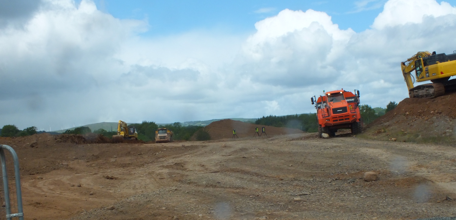
11 Sep 2020: To date work that has
taken place on the scheme has included the
earthworks plus a retaining wall in the Six Mile
Water, presumably for the bridge. Work was
paused due to the Covid-19 pandemic but is due
to get underway again at some point in the next
few months. The next phase of work will include
the construction of the roundabout on Doagh Road
plus drainage works. With thanks to the
contractor, Duo Operations Ltd, for info on the
current situation. So it looks likely to me that
the first element of the Western Relief Road to
be completed will be the stretch from the A57 to
Doagh Road, which will be extremely useful as it
will bypass the main street of the town.
12 Jun 2020: At long last more work is
taking place on this long-anticipated scheme.
The roundabout at the very southern end of the
scheme, along with 100 metres of the relief
road, were completed in mid 2018 to service the
"Ollar Valley" development. However, Neptune
Group was granted full planning permission for
the southern section remainder
of the relief road in November 2019 (it must be
a modified plan as permission was granted in
2011) and work now seems to be underway on the
central section, around Doagh Road. Vegetation
clearance work seems to have been carried out in
early 2019 ahead of this work. An aerial view
recently shared on Facebook
suggests that this, too, is intended to serve a
new housing development and doesn't seem to be
the provision of the whole relief road. The
plans do show a roundabout here, so the works
that are underway will likely lead to the
construction of that, plus a stretch of the
relief road on either side. It could be some
years before the whole relief road is built, as
developers tend only to build parts of roads as
they are needed. The photos below were shared by
Alan Robinson. Thanks also to Jay Burbank for
the heads-up that this work was underway.
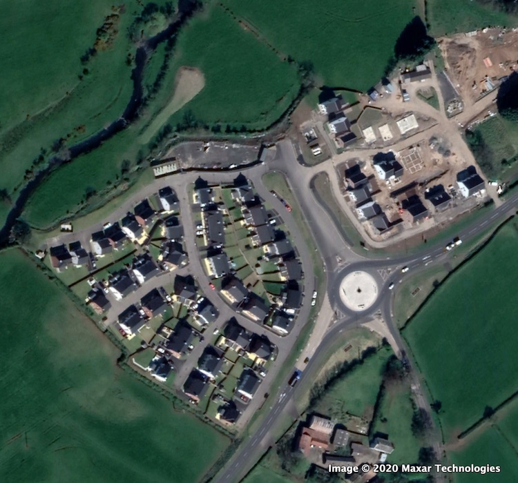
The completed roundabout on the A57 (which runs
bottom left to top right) as of 2020. It was
completed in mid 2018 along with the first 100
metres of the relief road to serve the Ollar
Valley development. [Google Earth]
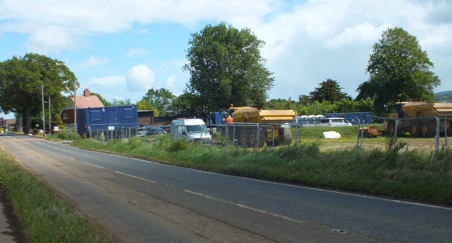
View north-east along Doagh Road (towards
Ballyclare) on 5 June 2020 showing a site yard
in place and heavy plant on site. This is to the
the site of a new roundabout which will carry
the relief road from left to right across Doagh
Road here. [Alan Robinson]
Earthworks underway on the future Ballyclare
Relief Road near Doagh Road on 5 June 2020 [Alan
Robinson].
Telephoto shot taken from Doagh Road, Ballyclare
looking south-east towards the existing
roundabout on the A57. The new road will
eventually run from the roundabout shown to the
Doagh Road, though this will require a new
bridge over the Six Mile Water and it does not
look as if the full link will be completed in
this phase of the works. [Alan Robinson]
23 Oct 2016: The Infrastructure Minister
was asked about this scheme in
the Assembly on 19 September. The Neptune
Group acquired the housing development in
question in November 2015 and indicated that
they would start work on the site early in 2017.
The provision of the Ballyclare Western Relief
Road is required for the development, but
presumably will not all be provided at once. In
fact, it could take up to 15 years, the time it
is estimated it will take to built all the
houses involved. The Minister said "There are
a number of locations throughout the North
where local councils stand in a prime position
to play a leading role, following the
devolution of various powers to them in recent
years, such as their capacity for financial
borrowing, to give one example. Certainly,
either on their own or in conjunction with the
Department, and with local developers, there
is the potential to look at this." This
suggests Antrim and Newtownabbey Borough Council
could yet have a role in this scheme. The
developer does need to pay for the road, but
perhaps the council could provide a loan on
favourable terms to allow it to be built at an
earlier date.
6 Apr 2016: It's been almost four years
since this page was last updated, because the
economic slowdown caused the Ballyclare West
housing project, of which this road is a
component, to be put on the long finger in 2012.
KPL Group, the developer behind it, then went
into administration
in February 2014 shortly after the land had been
sold off. In November 2015 the land was acquired
by Neptune Group who said in a statement
on their web site that "we plan to start work
on the site [which is primarily a housing
development] early next year. We intend to
liaise closely with the local community and
elected representatives in order that the new
proposed link road can be constructed in a
timely fashion". The scheme got a brief
mention in a Written
Answer in the Assembly about six weeks ago
(question AQO 9691/11-16). The DRD Minister
noted that the DRD will "assist this
development where possible", which is all
they can really do since the scheme is
"developer led". A developer led project is one
that exists primarily to service a private
development and must therefore be paid for by
the private developer, albeit built to the
required standard to become DRD property when
finished. All of this does give us some hope
that we might see work on the road resume over
the next few years, but we'll have to wait and
see what Neptune Group decide to do.
20 May 2012: It seems that the decline in the
housing market has now hit this scheme.
According to the Newtownabbey
Today, the scheme is now on hold for
an unknown length of time due to lack of
money. The developer, KPL Group, said that
the scheme is "facing a slight delay due to a
reduction in capital provisions"
although they point out that they have
already invested a considerable sum in
preparatory works, and hence are still
committed to it. It seems as if the scheme
will have to wait until the housing market
picks up again. It is not known how long the
delay will be, but it may be some time,
hence I have moved this scheme back down the
priority list.
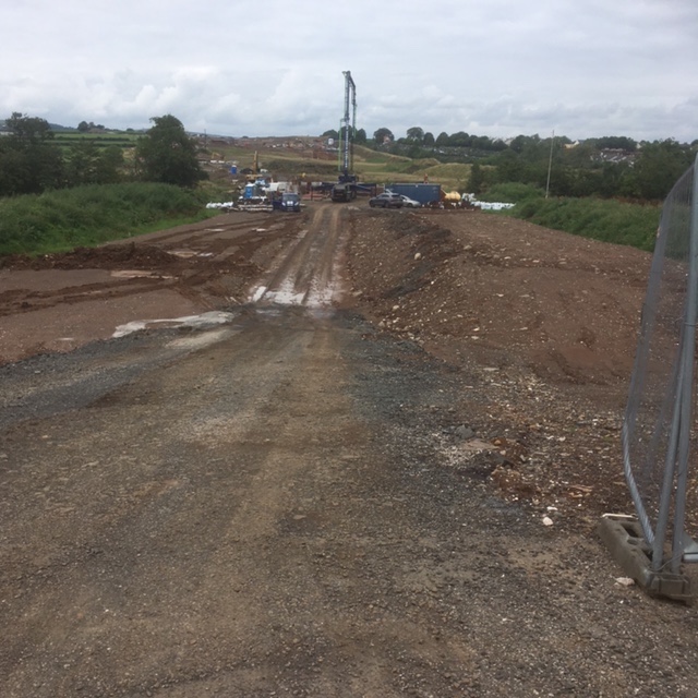
25 Feb 2012: I was past the site today and
took a photo looking along the route of the
first phase of this road (see below). It
suggests that at least some preparatory work
has now taken place. Firstly, there is a
distinct mark in the grass of the field that
coincides with the line of the road. This
suggests that either some vegetation
clearance has taken place, or that the line
of the road has been marked out in some
other way. Secondly, it looks as if some
trees have been removed close to where the
road will cross the Six Mile Water
(foreground of pic). I may be clutching at
straws a bit here, but since work is due to
begin around now this could be a sign that
something is finally moving.
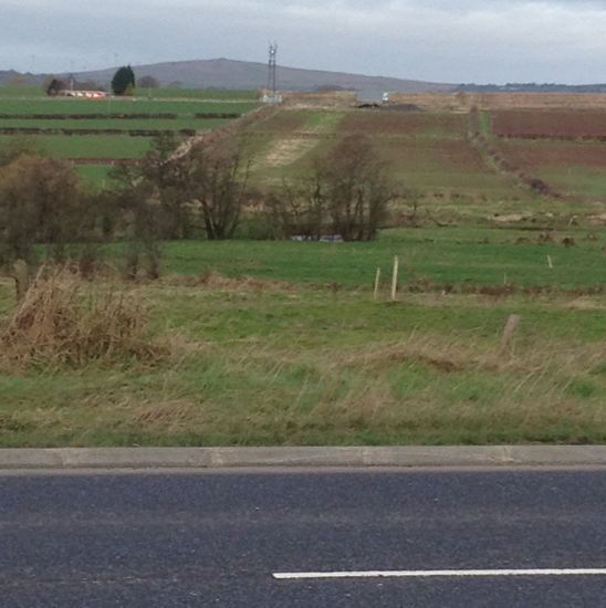
Looking north west from the A57
Templepatrick Road/Ballyrobert
Road junction, along the line of the new road
(see map above for guidance). Note the light
coloured area on the side of the hill, and the
apparent tree removal to the right of centre.
Taken on 25 Feb 2012. [Wesley Johnston]
12 Dec 2011: According to Newtownabbey
Today, work on the first phase of this
road is now due to start in February 2012.
We had previously expected work to begin
during the past year, but there has been no
evidence of work and no explanation.
According to the article, the reason for the
delay was "environmental
regulations when several [12] badger setts
were discovered along the proposed
two-mile route". Hopefully we will
see work begin within this timescale.
5 Jun 2011: Work has still not
begun on the road. However I was at the site of
the associated housing development last week and
one of the people working on the site said that
they thought the work on the road would be
beginning "in July". This is not official
information, so could be completely wrong, but
as it's all we have I am sharing it anyway! The
property company has now set up a web site which
devotes
a page to the road (but with no maps)
which it calls the "Westlands Link Road",
although the final say on the road name lies
with Newtownabbey Borough Council.
14 Jan 2011: After much delay,
planning permission for this proposed road and
associated housing development has
finally been granted. It is not clear when
construction on the road will begin, except to
note that (i) KPL seem keen to proceed (ii) work
on the road will begin prior to the bulk of the
housing development. As it is being progressed
by a private developer there are unlikely to be
any announcements when work does begin.
18 Sep 2010: Work had been due
to get underway on the new road in August 2010,
but this did not happen. According to the Newtownabbey
Today, the delay is due to the fact that
the Planning Appeals Commission have delayed the
publication of their report into the inquiry
into the Belfast Metropolitan Area Plan 2015
(BMAP) until at least March 2011. As this road
scheme is part of the BMAP, it is likely to be
affected by this delay. The developer (KPL) has
not commented, so their position is unknown.
June 2010: According to Newtownabbey
Today, work on the houses associated with
this development began in May, on land off
Rashee Road. However, work on the road did not
begin in April 2010 as was anticipated back in
August last year. It has now emerged that
approval for the road cannot be given until the
finalised Belfast Metropolitan Area Plan 2015
(BMAP) has been published. This is presumably
because provision of the link road is included
in the BMAP and is hence part of the plan. The
BMAP *may* be published later in 2010, but no
firm date has been given. The developer (KPL
Group) is saying that work may begin on the road
in "August 2010", but with the dependency on
BMAP this seems very optimistic. The article has
also confirmed that the road will be built in
two stages. The 1km section from Templepatrick
Road to Doagh Road will be built first, with the
extension to Rashee Road following later,
possibly a year or more later.
Photos
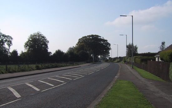
The view west along Doagh Road,
Ballyclare. The new road will cross this road
a few hundred metres ahead. Taken in 2003.
[Wesley Johnston]
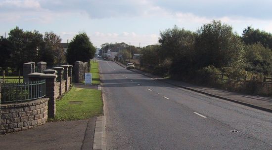
Looking south, towards
Ballyclare, along Rashee Road from the Cogry
Road junction. The new road will terminate near
where the car is parked. Taken in 2003. [Wesley
Johnston]
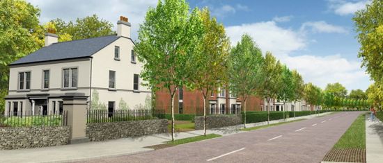
Artist's impression of how the
new road and associated housing development
will look. Picture obtained from the Irish
Construction site. [KPL Group]
|