|
|
Status
|
Construction scheme
(current) |
|
Where
|
To
build a new link from Whitehouse Road to
the A2 Buncrana Road at Skeoge
roundabout
|
|
Total
Length
|
Approx 1.0 km / 0.6
miles
|
|
Dates
|
Planning permission
granted for housing scheme - Dec 2017
Work began on road -
circa 2024
Completed but unopened - as of Apr 2026
|
|
Cost
|
Unknown - funded by
private developers. |
|
See
Also
|
General area
map
|
Click here
to jump straight down to updates.
This scheme is being undertaken by a private
developer and will see a new road link directly
from the A2 Buncrana Road at Skeoge Roundabout
to the Whitehouse Road, in order to serve a
large new housing development. The existing
Whitehouse Road, which joins the Buncrana Road
at a t-junction, will remain in place but
separated from the new road. The new road
largely obliterates a 500 metre section of the
18th century Coshquin Road (which was the main
road before Buncrana Road was built in the 19th
century). Parts of it will remain in use as a
local road. The map below shows the plan.The red
highlights the sections of old road to be
abandoned.
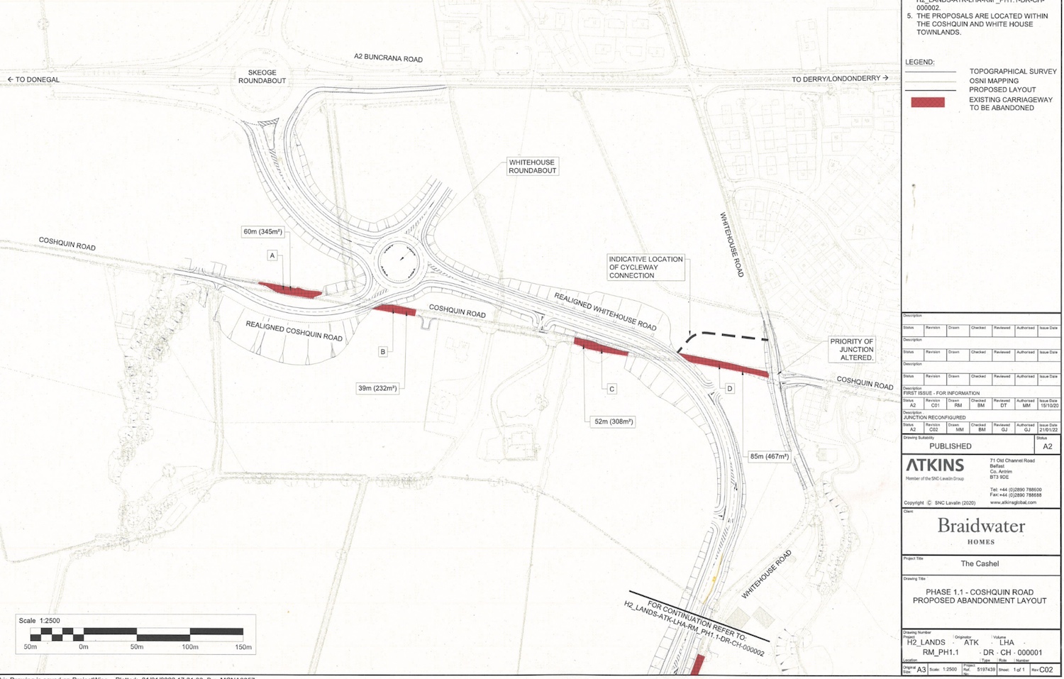
Developer map dating from 2022 showing the
proposed road. North is to the upper left. Click
to view larger.
Image from Braidwater Homes/Atkins.
Updates
24 Apr 2026: I
had not planned to do a page for this scheme
until a site visitor emailed me to comment on
how large the road looked. Indeed this is true:
the section south from Skeoge Roundabout is four
lanes across, and includes another new
roundabout. Nevertheless, when it is finally
adopted by DFI, it is likely to be either an
unclassified Road or B-class at most because it
has been build primarily to serve a large new
housing development. Work on the road began
around 2024 and is now largely complete.
However, it has not been opened to the public
and is currently being used as an access road to
the housing development which is now getting
underway. Progress can
be seen on Google Maps, especially this Streetview
link.
|
