Status |
Construction schemes (completed) |
Where |
A north-south bypass of Strabane, on the strategic Dublin to Londonderry Road |
Total Length |
4.3km / 2.7 miles (1km / 0.6 miles would have been added in stage 3) |
Opened |
Phase 1 - 1992
Phase 2 - 24 Sep 2003
Phase 3 - never built; scheme cancelled Nov 2007 |
Cost |
c£4 million (for phase 1)
£4.5 million (for phase 2) |
Photos / Map |
See below |
See Also |
General area map - Google Maps.
A5 Strabane Bypass Stage 3 on this site
A5 Strabane to N14/N15 Lifford link road on this site
A5 dualling on this site |
Strabane is a regional town in the north west of county Tyrone and only a few hundred metres from the border with the Republic of Ireland. It straddles the strategic A5 route which as well as being the main north-south route in the west of the province is also part of the main Dublin to Londonderry route. Since the town is quite large, traffic in the centre had become chronic.
The Strabane Bypass as originally planned will never be completed – it had been planned for many years and construction was to proceed in three stages. The first stage, which opened in 1992, involved building part of the northern half of the bypass and a new bridge over the River Mourne. The second stage which opened in September 2003, extended it round to the southern end of the town. The third stage would have extended it a further 1km north to the absolute northern limits of the built-up area. However this phase was cancelled in November 2007, prior to work commencing, when it was decided to upgrade the entire A5 to dual-carriageway standard instead.
Much of the bypass follows the route of the former railway line from Omagh to Londonderry.
Map
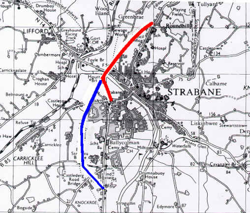
Map of stage 1 (red) and stage 2 (blue) of the Strabane Bypass. [From Roads Service Web Site]
Photos
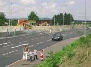
The completed Strabane Bypass.
[Photo from issue 2 of the Roads Service magazine "On the Move", December 2003]
See also Google Streetview for images of most of the route. |
